
Schloss Gültz
Coat of arms of von Maltzahn-Gültz
Schloss Gültz
Historic Manor House · Anno MDCCCLXXII
Sprache · Language · Język
Cartographic Documentation

Historic Maps

Ordnance survey maps (Messtischblätter) of the Royal Prussian Land Survey 1886–1944

Topographic maps 1:25,000

Sheet 2245 Gültz

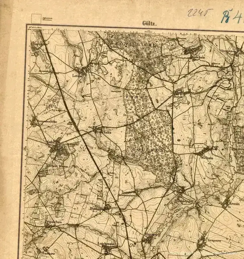
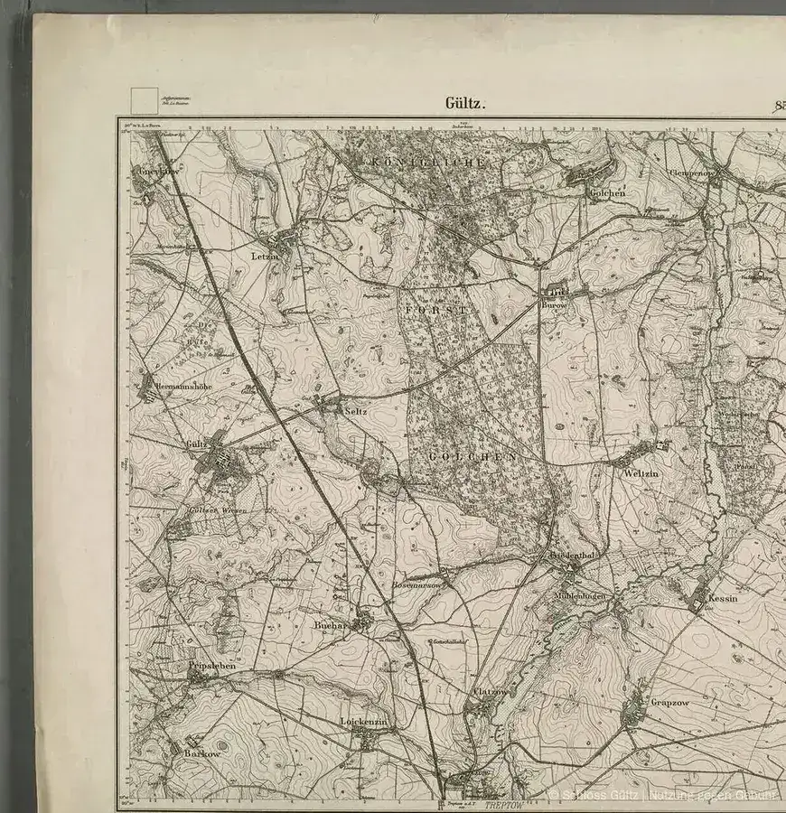
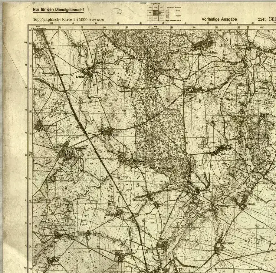
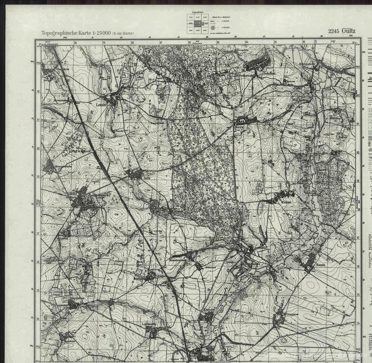
The ordnance survey maps (Messtischblätter) of the Royal Prussian Land Survey document Schloss Gültz and the Lenné park over a period of 58 years. The first edition of 1886 shows the manor house just 14 years after its completion – a unique record of its original state.

Ordnance survey map (Messtischblatt) 2245 Gültz - First edition 1886
Ordnance survey map (Messtischblatt) 2245 Gültz - Second edition 1898
Ordnance survey map (Messtischblatt) 2245 Gültz - Wartime edition 1941
Ordnance survey map (Messtischblatt) 2245 Gültz - Last edition 1944
First edition · Sheet 856 Gültz
Surveyed by First Lieutenant La Baume, published 1886 · Royal Prussian Land Survey
At a glance

All four editions

1886
Ordnance survey map 1886
First edition
Prussian Land Survey
1898
Ordnance survey map 1898
Second edition
Sheet 856
1941
Ordnance survey map 1941
Wartime edition
Sheet 2245
1944
Ordnance survey map 1944
Last edition
Military
Map analysis

Changes as shown on the maps

1886 First edition

  • Original survey by the Prussian Land Survey
  • Surveyed by First Lieutenant (Premierlieutenant) La Baume
  • Manor house just 14 years after construction
  • Lenné park in its original state
  • Oldest available map depiction
  • Monochrome copper-engraving lithograph

1898 Second edition

  • Updated additions to the first edition
  • Sheet 856 (old numbering)
  • “Königliche Forst Golchen” (Royal Forest of Golchen) marked
  • “Gültzer Wiesen” (Gültz Meadows) south of the estate
  • Park structure largely unchanged
  • Source: Leibniz-Institut für Länderkunde

1941 Wartime edition

  • Multicoloured: bodies of water shown in blue
  • New numbering: Sheet 2245
  • Altentreptow–Neubrandenburg railway line
  • Expanded road infrastructure
  • Changes in woodland parcelling
  • Source: McMaster University, Canada

1944 Last edition

  • Complete legend in the margin
  • “Planzeiger” (grid reference scale) for military use
  • Magnetic declination marked
  • Reichsamt für Landesaufnahme (Reich Office for Land Survey)
  • Last update before the end of the war
  • Source: UC Berkeley, USA

58 years of cartographic history

1886
First edition
1898
2nd edition
1941
Wartime edition
1944
Last edition

The Lenné park in historical maps

The first edition of 1886 shows the Gültz manor house (built 1868–1872) and the park designed by Peter Joseph Lenné in their most authentic state – just 14 years after the building was completed. This oldest available map documents the winding park paths, the sightlines and the characteristic connection between estate park and cultural landscape in their original form. The field name “Gültzer Wiesen” south of the village refers to the lands belonging to the estate. Over the following 58 years up to 1944, the map editions document the progressive development of the region’s infrastructure, while the basic structure of the historic Lenné park remained remarkably constant.

Map sources:

Royal Prussian Land Survey (1886) · Leibniz-Institut für Länderkunde (1898) · McMaster University Library (1941) · UC Berkeley (1944)

Further sources: Deutsche Digitale Bibliothek (University of Greifswald) · MAPSTER/igrek.amzp.pl (Poland) · Geoportal Mecklenburg-Vorpommern · Deutsche Fotothek (SLUB Dresden) · Herder-Institut Marburg (oblique aerial photographs)